
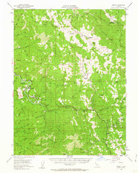
1952 Map of Leggett
USGS Topo · Published 1954About this map
The South Fork Eel River winds through this Mendocino County landscape, where the Redwood Highway serves as a primary artery connecting mountain settlements. Local life in the early 1950s is centered around Leggett, supported by the nearby Leggett Airstrip and recreational spots like Edward R Hickey State Park and Tan Oak Park. The map documents a period of transition, showing established family holdings such as Drewry Ranch, Linser Ranch, and Redwine Ranch alongside industrial traces like the Linser Mine. Travel beyond the main highway relies on a network of historic routes including Mail Ridge Road and the Bell Springs Road, which climb toward high points like Red Mountain and Brush Mountain. In the northeast corner, the Northwestern Pacific RR follows the rugged canyon, marking the edge of the Trinity and Mendocino County line.
Find a feature on this map
70 named features on this map. Tap any name to fly to it.
Don’t see what you’re looking for? This feature index may not catch every label — zoom into the map to look around manually.
Map Details
Editions of this 1952 Leggett Map
3 editions found
Other maps of this area

1920 · Cummings
USGS Topo · 1:62,500

1920 · Covelo
USGS Topo · 1:62,500

1920 · Harris
USGS Topo · 1:62,500

1921 · Westport
USGS Topo · 1:62,500

1921 · Briceland
USGS Topo · 1:62,500

1921 · Branscomb
USGS Topo · 1:62,500

1921 · Hoaglin
USGS Topo · 1:62,500

1922 · Island Mountain
USGS Topo · 1:62,500

1931 · Hoaglin
USGS Topo · 1:96,000

1935 · Hoaglin
USGS Topo · 1:125,000