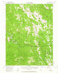
1952 Map of Leggett
USGS Topo · Published 1962About this map
The South Fork Eel River carves a deep path through the Mendocino wilderness, anchoring the settlement of Leggett and the nearby Edward R Hickey State Park. During this mid-century period, the landscape is defined by remote ranches and family outposts such as Drewry Ranch, Blue Rock Ranch, and the Redwine Ranch. The rugged geography of Red Mountain Ridge and Brush Mountain Ridge dictates the path of local travel, with a small Airstrip serving as a vital connection for this isolated territory.
Find a feature on this map
82 named features on this map. Tap any name to fly to it.
Don’t see what you’re looking for? This feature index may not catch every label — zoom into the map to look around manually.
Map Details
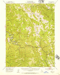
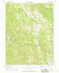
Editions of this 1952 Leggett Map
3 editions found
Other maps of this area

1920 · Cummings
USGS Topo · 1:62,500

1920 · Covelo
USGS Topo · 1:62,500

1920 · Harris
USGS Topo · 1:62,500

1921 · Westport
USGS Topo · 1:62,500

1921 · Briceland
USGS Topo · 1:62,500

1921 · Branscomb
USGS Topo · 1:62,500

1921 · Hoaglin
USGS Topo · 1:62,500

1922 · Island Mountain
USGS Topo · 1:62,500

1931 · Hoaglin
USGS Topo · 1:96,000

1935 · Hoaglin
USGS Topo · 1:125,000