
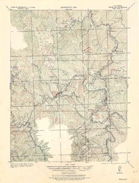
1921 Map of Briceland
USGS Topo · Published 1921About this map
Briceland and Garberville anchor this 1916 survey, published just as the State Highway system was beginning to formalize travel through the redwood country of southern Humboldt County. The landscape is defined by the winding course of the South Fork Eel River and the Mattole River, which shaped the early development of the region.
Find a feature on this map
55 named features on this map. Tap any name to fly to it.
Don’t see what you’re looking for? This feature index may not catch every label — zoom into the map to look around manually.
Map Details
Editions of this 1921 Briceland Map
2 editions found
Other maps of this area

1919 · Glynn
USGS Topo · 1:62,500

1920 · Pt. Delagda
USGS Topo · 1:62,500

1920 · Cummings
USGS Topo · 1:62,500

1920 · Harris
USGS Topo · 1:62,500

1921 · Dyerville
USGS Topo · 1:62,500

1949 · Eureka
USGS Topo · 1:250,000

1949 · Blocksburg
USGS Topo · 1:62,500

1949 · Alderpoint
USGS Topo · 1:62,500

1949 · Point Delgada
USGS Topo · 1:62,500

1949 · Garberville
USGS Topo · 1:62,500