
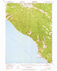
1949 Map of Point Delgada
USGS Topo · Published 1958About this map
The King Range dominates this coastal survey, where the steep terrain of the Lost Coast drops directly into the Pacific Ocean. This 1949 field check captures a period of early post-war development in southern Humboldt County, most notably at Shelter Cove, where an Airstrip and small settlement are situated near the prominent Point Delgada. To the north, the isolated community of Honeydew serves as a lone hub along the Mattole River, surrounded by a network of ridges such as Moody Ridge and Telegraph Ridge.
Find a feature on this map
62 named features on this map. Tap any name to fly to it.
Don’t see what you’re looking for? This feature index may not catch every label — zoom into the map to look around manually.
Map Details
Editions of this 1949 Point Delgada Map
2 editions found
Other maps of this area

1919 · Glynn
USGS Topo · 1:62,500

1920 · Pt. Delagda
USGS Topo · 1:62,500

1921 · Dyerville
USGS Topo · 1:62,500

1921 · Briceland
USGS Topo · 1:62,500

1921 · Cape Mendocino
USGS Topo · 1:62,500

1926 · Gorda
USGS Topo · 1:62,500

1949 · Eureka
USGS Topo · 1:250,000

1949 · Garberville
USGS Topo · 1:62,500

1949 · Weott
USGS Topo · 1:62,500

1950 · Piercy
USGS Topo · 1:62,500