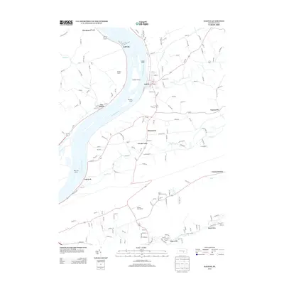
2013 Map of Halifax
USGS Topo · Published 2013About this map
The Susquehanna River dominates this landscape, its waters divided by a series of significant landforms including Clemson Island, Lingle Island, and Bressler Island. The river’s course is marked by the Half Falls and the prominent Girtys Notch, illustrating the geological character of the valley. Settlement patterns are tied closely to the water, with the borough of Halifax on the eastern bank and New Buffalo on the western shore.
Find a feature on this map
155 named features on this map. Tap any name to fly to it.
Don’t see what you’re looking for? This feature index may not catch every label — zoom into the map to look around manually.
Map Details
Editions of this 2013 Halifax Map
This is the sole edition of this map. No revisions or reprints were ever made.
Other maps of this area

1892 · Harrisburg
USGS Topo · 1:62,500

1893 · Millersburg
USGS Topo · 1:62,500

1899 · Harrisburg
USGS Topo · 1:62,500

1907 · New Bloomfield
USGS Topo · 1:62,500

1907 · Millerstown
USGS Topo · 1:62,500

1924 · Harrisburg
USGS Topo · 1:62,500

1943 · Millerstown
USGS Topo · 1:62,500

1943 · Millersburg
USGS Topo · 1:62,500

1943 · Harrisburg
USGS Topo · 1:62,500

1943 · New Bloomfield
USGS Topo · 1:62,500
Featured Places
- New Buffalo, PA
- Reed Township, PA
- Watts Township, PA
- Half Falls, Watts Township
- Singersville, Middle Paxton Township