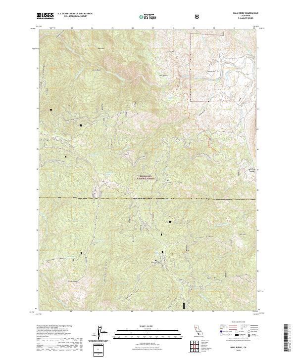
2022 Map of Hall Ridge
USGS Topo · Published 2022About this map
Mendocino National Forest encompasses the high-relief terrain of the California Coast Ranges where the Tehama and Glenn County line bisects the landscape. The drainage patterns are defined by the Thomes Creek system, including the narrow passage of The Gorge and its surrounding high points like Gunsight and Hall Ridge. Settlement is sparse in this protected wilderness, marked primarily by isolated clearings and natural features such as Scotts Glade and Lake Hollow. Historic travel routes, such as the Paskenta-Mendocino Pass, traverse the ridgelines, providing access to a network of seasonal springs including Buck Spring, Commissary Spring, and Round Spring. The topography reveals a complex series of named ridges, from the prominent Digger Ridge to the southern reaches of Skidmore Ridge and Kilgore Ridge, reflecting the early naming conventions of local surveyors and foresters.
Find a feature on this map
46 named features on this map. Tap any name to fly to it.
Don’t see what you’re looking for? This feature index may not catch every label — zoom into the map to look around manually.
Map Details
Editions of this 2022 Hall Ridge Map
This is the sole edition of this map. No revisions or reprints were ever made.
Other maps of this area

1919 · Elk Creek
USGS Topo · 1:62,500

1948 · Elk Creek
USGS Topo · 1:62,500

1952 · Paskenta
USGS Topo · 1:62,500

1952 · Hull Mountain
USGS Topo · 1:62,500

1952 · Anthony Peak
USGS Topo · 1:62,500

1957 · Elk Creek
USGS Topo · 1:62,500

1957 · Ukiah
USGS Topo · 1:250,000

1960 · Ukiah
USGS Topo · 1:250,000
1967 · Plaskett meadows
USGS Topo · 1:24,000
1967 · Log Spring
USGS Topo · 1:24,000