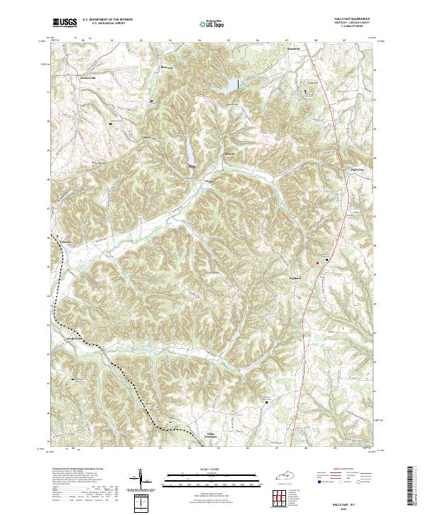
2022 Map of Halls Gap
USGS Topo · Published 2022About this map
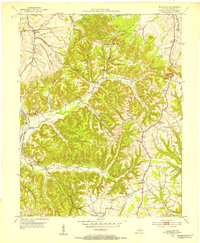
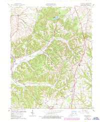
Greasy Ridge and Naylor Ridge define the complex topography of Lincoln County where the headwaters of the Green River and the S Fork Green River begin their westward journey. This landscape is marked by a deep network of hollows, including Peck Hollow and Boneyard Hollow, which dictate the winding paths of rural routes like State Hwy 698 and State Hwy 198. The map documents a classic Kentucky ridge-and-valley settlement pattern, where small communities like Miracle, Jumbo, and Geneva are connected by narrow roads following the terrain.
Find a feature on this map
96 named features on this map. Tap any name to fly to it.
Don’t see what you’re looking for? This feature index may not catch every label — zoom into the map to look around manually.
Map Details
Editions of this 2022 Halls Gap Map
This is the sole edition of this map. No revisions or reprints were ever made.
Historical Maps of Highland Through Time
3 maps found