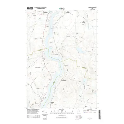
2014 Map of Hampden
USGS Topo · Published 2014About this map
The Penobscot River serves as the central artery for this region south of Bangor, separating the riverside settlements of Hampden and Winterport on the western bank from Orrington and Bucksport to the east. The landscape is defined by the river’s winding course, including the Bald Hill Reach and Bald Hill Cove, which influenced the placement of early homes and cemeteries. Numerous family-named landmarks and local burial grounds like Locust Grove Cem and Village Cem are documented alongside established neighborhoods such as Hampden Highlands and North Bucksport. The map captures the meeting point of Penobscot, Waldo, and Hancock counties, tracing how property and municipal boundaries follow the natural topography of hills like Punchbowl Hill and water bodies including Swetts Pond and the Souadabscook Stream Reservoir.
Find a feature on this map
115 named features on this map. Tap any name to fly to it.
Don’t see what you’re looking for? This feature index may not catch every label — zoom into the map to look around manually.
Map Details
Editions of this 2014 Hampden Map
This is the sole edition of this map. No revisions or reprints were ever made.
Other maps of this area

1900 · Orland
USGS Topo · 1:62,500

1900 · Bucksport
USGS Topo · 1:62,500

1902 · Orono
USGS Topo · 1:62,500

1902 · Bucksport
USGS Topo · 1:62,500

1902 · Bangor
USGS Topo · 1:62,500

1942 · Orland
USGS Topo · 1:62,500

1942 · Bangor
USGS Topo · 1:62,500

1942 · Bucksport
USGS Topo · 1:62,500

1944 · Orono
USGS Topo · 1:62,500

1946 · Bangor
USGS Topo · 1:62,500