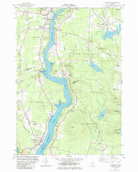
1982 Map of Hampden
USGS Topo · Published 1982About this map
The Penobscot River serves as the central artery for this 1982 survey, dividing the landscape between Penobscot, Waldo, and Hancock Counties. On the western bank, the town of Hampden and its residential core at Hampden Highlands show a community anchored by local institutions like the Academy and Weatherbee-McGraw Sch, with the Bangor and Aroostook railroad line tracing the shoreline. Across the water, the town of Orrington is marked by scattered settlements such as North Orrington and South Orrington, alongside landmarks like Smith Ledge and Pine Hill. The map captures a transition toward modern suburban development, visible in the Center Drive Sch and several sand and gravel operations, while preserving older cemetery sites like Riverview Cem and Oak Hill Cem. To the south, the terrain rises toward Cobb Hill and Kings Mtn, overlooking Swetts Pond and the river’s widening reach toward North Bucksport.
Find a feature on this map
60 named features on this map. Tap any name to fly to it.
Don’t see what you’re looking for? This feature index may not catch every label — zoom into the map to look around manually.
Map Details
Editions of this 1982 Hampden Map
This is the sole edition of this map. No revisions or reprints were ever made.
Other maps of this area

1900 · Orland
USGS Topo · 1:62,500

1900 · Bucksport
USGS Topo · 1:62,500

1902 · Orono
USGS Topo · 1:62,500

1902 · Bucksport
USGS Topo · 1:62,500

1902 · Bangor
USGS Topo · 1:62,500

1942 · Orland
USGS Topo · 1:62,500

1942 · Bangor
USGS Topo · 1:62,500

1942 · Bucksport
USGS Topo · 1:62,500

1944 · Orono
USGS Topo · 1:62,500

1946 · Bangor
USGS Topo · 1:62,500