
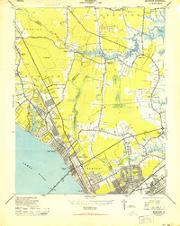
1944 Map of Hampton
USGS Topo · Published 1944About this map
Hampton and its surrounding peninsula communities are depicted during the height of the Second World War, showing a landscape defined by significant military and institutional footprints. The massive installations of Langley Field and the U.S. Military Reservation at Fort Monroe dominate the shoreline, while the National Soldiers Home and National Cem highlight the area's long-standing connection to veteran care and service. The map records the intricate waterways of the Back River and Hampton River, which shaped local commerce at Amorys Wharf and Back Landing.
Find a feature on this map
94 named features on this map. Tap any name to fly to it.
Don’t see what you’re looking for? This feature index may not catch every label — zoom into the map to look around manually.
Map Details
Editions of this 1944 Hampton Map
This is the sole edition of this map. No revisions or reprints were ever made.
Other maps of this area

1907 · Norfolk
USGS Topo · 1:125,000

1907 · Hampton
USGS Topo · 1:62,500

1918 · Cape Henry
USGS Topo · 1:62,500

1919 · Cape Henry
USGS Topo · 1:62,500

1921 · Newport News
USGS Topo · 1:62,500

1943 · Richmond
USGS Topo · 1:250,000
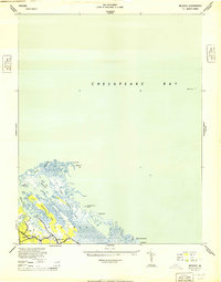
1944 · Messick
USGS Topo · 1:24,000
1944 · Morrison
USGS Topo · 1:24,000
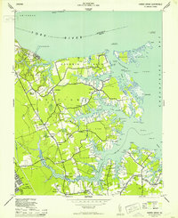
1944 · Harris Grove
USGS Topo · 1:24,000

1948 · Ocean View
USGS Topo · 1:24,000