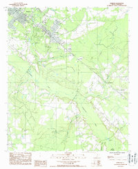
1988 Map of Hampton
USGS Topo · Published 1988About this map
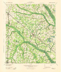
Hampton and neighboring Varnville anchor the northwestern portion of this South Carolina Lowcountry landscape, where the street grids transition abruptly into a dense network of blackwater drainage systems. The Coosawhatchie River snakes through the center of the quadrangle, fed by numerous tributaries including House Fork, Sanders Branch, and Cowpen Branch. The proximity of these settlements to the swampy river bottoms suggests the historic importance of timber and rail access in the late 20th century. Toward the southeast, the landscape opens slightly around Lowndes Lake and the community of Camp Branch, while a prominent Transmission Line cuts across the terrain, marking modern infrastructure development. Small unincorporated areas like Almeda remain tucked between the waterways, illustrating the traditional rural settlement patterns that have persisted along the Hampton Co Jasper Co boundary.
Find a feature on this map
15 named features on this map. Tap any name to fly to it.
Don’t see what you’re looking for? This feature index may not catch every label — zoom into the map to look around manually.
Map Details
Editions of this 1988 Hampton Map
This is the sole edition of this map. No revisions or reprints were ever made.
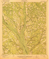
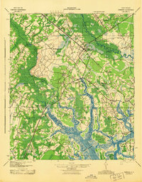
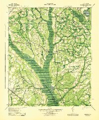
Other maps of this area

1918 · Varnville
USGS Topo · 1:62,500

1918 · Yemassee
USGS Topo · 1:62,500

1919 · Pineland
USGS Topo · 1:62,500
1919 · Cummings
USGS Topo · 1:62,500

1943 · Pineland
USGS Topo · 1:62,500
1943 · Yemassee
USGS Topo · 1:62,500
1943 · Cummings
USGS Topo · 1:62,500
1944 · Varnville
USGS Topo · 1:62,500

1947 · Savannah
USGS Topo · 1:250,000

1948 · Savannah
USGS Topo · 1:250,000