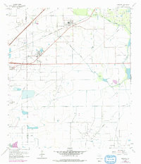
1962 Map of Hamshire
USGS Topo · Published 1978About this map
The Gulf Colorado and Santa Fe railroad cuts a diagonal path across this Jefferson County landscape, serving as a primary corridor between the settlements of Hamshire and Winnie. In the early 1960s, the region's economy was clearly defined by extensive petroleum extraction, evidenced by the large Fannett Oil Field, Stowell Field, and the Big Hill Oil Field. These industrial zones are marked by a dense network of pumping stations and pipelines that traverse the coastal plains.
Find a feature on this map
20 named features on this map. Tap any name to fly to it.
Don’t see what you’re looking for? This feature index may not catch every label — zoom into the map to look around manually.
Map Details
Editions of this 1962 Hamshire Map
2 editions found
Other maps of this area

1943 · Sea Breeze
USGS Topo · 1:24,000

1943 · Stowell
USGS Topo · 1:24,000

1943 · Fannett East
USGS Topo · 1:24,000

1945 · Fannett East
USGS Topo · 1:31,680

1945 · Nolte
USGS Topo · 1:31,680

1945 · Sea Breeze
USGS Topo · 1:31,680

1950 · Houston
USGS Topo · 1:250,000

1956 · Houston
USGS Topo · 1:250,000

1961 · Star Lake
USGS Topo · 1:24,000
1962 · Stanolind Reservoir
USGS Topo · 1:24,000