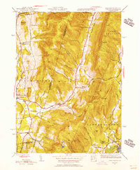
1944 Map of Hancock
USGS Topo · Published 1956About this map
The Taconic Mountains define the border between New York and Massachusetts in this mid-1940s survey, creating a landscape of high ridges and deep hollows. Hancock and Stephentown serve as the primary valley settlements, connected by a network of rural routes like Main Road and Potter Road. The map captures a moment when small schoolhouses like Balance Rock Sch and Sch at Gorton still served these isolated mountain communities. High peaks such as Brodie Mountain and Misery Mountain dominate the skyline, while the Fire Tower on Brodie suggests the importance of forest monitoring during this era.
Find a feature on this map
68 named features on this map. Tap any name to fly to it.
Don’t see what you’re looking for? This feature index may not catch every label — zoom into the map to look around manually.
Map Details
Editions of this 1944 Hancock Map
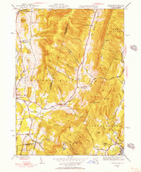
2 editions found
Other maps of this area

1886 · Greylock
USGS Topo · 1:62,500

1886 · Becket
USGS Topo · 1:62,500

1888 · Becket
USGS Topo · 1:62,500

1888 · Berlin
USGS Topo · 1:62,500

1888 · Pittsfield
USGS Topo · 1:62,500

1890 · Pittsfield
USGS Topo · 1:62,500

1890 · Berlin
USGS Topo · 1:62,500

1891 · Greylock
USGS Topo · 1:62,500

1893 · Becket
USGS Topo · 1:62,500

1893 · Greylock
USGS Topo · 1:62,500