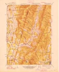
1948 Map of Hancock
USGS Topo · Published 1948About this map
The Taconic Mountains and steep valleys of the New York-Massachusetts border define the landscape in this mid-century survey. Steep ridgelines like Brodie Mountain and Rounds Mountain separate the drainages of Kinderhook Creek and the West Branch Green River. Local life centers on the cross-border settlements of Hancock and Stephentown, where the valley floors provided the only level ground for agriculture and transit along the Main Road. Rural education and community landmarks are prominent, including the Gorton Sch near North Hancock and the Balance Rock Sch in the southeast. Cultural features such as the Fire Tower on the heights of Brodie Mountain and the high-elevation waters of Berry Pond suggest a landscape used for both utility and early recreation. The map also traces the winding courses of numerous mountain brooks, including Whitman Brook and Sachem Brook, which historically powered the small-scale mills of the Berkshires.
Find a feature on this map
63 named features on this map. Tap any name to fly to it.
Don’t see what you’re looking for? This feature index may not catch every label — zoom into the map to look around manually.
Map Details
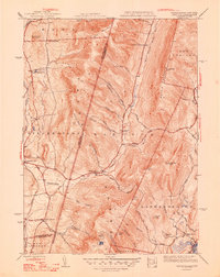
Editions of this 1948 Hancock Map
2 editions found
Other maps of this area

1886 · Greylock
USGS Topo · 1:62,500

1886 · Becket
USGS Topo · 1:62,500

1888 · Becket
USGS Topo · 1:62,500

1888 · Berlin
USGS Topo · 1:62,500

1888 · Pittsfield
USGS Topo · 1:62,500

1890 · Pittsfield
USGS Topo · 1:62,500

1890 · Berlin
USGS Topo · 1:62,500

1891 · Greylock
USGS Topo · 1:62,500

1893 · Becket
USGS Topo · 1:62,500

1893 · Greylock
USGS Topo · 1:62,500