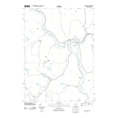
2010 Map of Hancock
USGS Topo · Published 2010About this map
The confluence of the West Branch Delaware River and the main stem of the Delaware River anchors this landscape, where the village of Hancock serves as a central hub for the surrounding New York and Pennsylvania borderlands. In the early 21st century, the terrain is defined by its water and high ground, from the steep ascent of Point Mountain to the remote waters of Starlight Lake and Hiawatha Lake. Long-established burial grounds like Riverview Cemetery and Kingsbury Hill Cemetery offer genealogical touchpoints for local families, while the Initial Monument near the river indicates the historically significant boundary line. Small settlements such as Winterdale, Cadosia, and Stockport are connected by a network of winding roads like Shehawken Rd and Winterdale Rd, reflecting a landscape of seasonal camps, campgrounds, and rural residences scattered among the hills and hollows.
Find a feature on this map
63 named features on this map. Tap any name to fly to it.
Don’t see what you’re looking for? This feature index may not catch every label — zoom into the map to look around manually.
Map Details
Editions of this 2010 Hancock Map
This is the sole edition of this map. No revisions or reprints were ever made.
Other maps of this area

1920 · Long Eddy
USGS Topo · 1:62,500

1921 · Long Eddy
USGS Topo · 1:48,000

1923 · Long Eddy
USGS Topo · 1:62,500

1923 · Walton
USGS Topo · 1:48,000

1924 · Starrucca
USGS Topo · 1:48,000

1924 · Deposit
USGS Topo · 1:62,500

1925 · Walton
USGS Topo · 1:62,500

1926 · Deposit
USGS Topo · 1:62,500

1926 · Starrucca
USGS Topo · 1:62,500

1930 · Starrucca
USGS Topo · 1:48,000