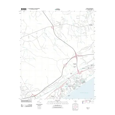
2011 Map of Hand
USGS Topo · Published 2011About this map
Hand and Star Bluff Crossroads sit north of the major coastal developments, representing the inland transition from agricultural lowlands to the bustling Grand Strand. This landscape is defined by the Intracoastal Waterway slicing through the terrain, separating the tidal reaches of Skimmer Bay and Long Pond from the inland basins of Jones Big Swamp and Horse Savannah. The southern portion of the map showcases the rapid modernization of the shoreline, with residential enclaves like Arcadian Shores and Northwood situated alongside established leisure destinations. The presence of Myrtle Beach Campground, Apache Campground, and Lake Arrowhead Campground illustrates the area's mid-century evolution into a premier Atlantic destination. Inland, family-named landmarks like Hemingway Lndg and historical routes like Old Reaves Ferry Rd hint at the riverine commerce and ferry crossings that predated the modern highway system.
Find a feature on this map
105 named features on this map. Tap any name to fly to it.
Don’t see what you’re looking for? This feature index may not catch every label — zoom into the map to look around manually.
Map Details
Editions of this 2011 Hand Map
This is the sole edition of this map. No revisions or reprints were ever made.
Other maps of this area

1937 · Myrtle Beach
USGS Topo · 1:48,000

1937 · Nixonville
USGS Topo · 1:48,000

1940 · Myrtle Beach
USGS Topo · 1:62,500

1942 · Nixonville
USGS Topo · 1:62,500

1943 · Wampee
USGS Topo · 1:24,000

1944 · Longs
USGS Topo · 1:31,680

1949 · Georgetown
USGS Topo · 1:250,000

1953 · Longs
USGS Topo · 1:24,000

1967 · Georgetown
USGS Topo · 1:250,000

1974 · Georgetown
USGS Topo · 1:250,000