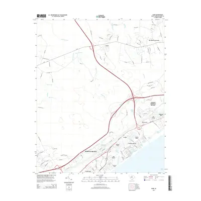
2014 Map of Hand
USGS Topo · Published 2014About this map
Intracoastal Waterway navigation and coastal development define this South Carolina landscape near the Horry County shoreline. The transition from the rural crossroads at Hand and Star Bluff Crossroads to the densely planned communities of North Myrtle Beach and Myrtle Beach is clearly visible. The map shows the coastal economy evolving through residential enclaves like Arcadian Shores and Dunes Cove, which are built around natural features like Singleton Swash and Dunes Lake.
Find a feature on this map
104 named features on this map. Tap any name to fly to it.
Don’t see what you’re looking for? This feature index may not catch every label — zoom into the map to look around manually.
Map Details
Editions of this 2014 Hand Map
This is the sole edition of this map. No revisions or reprints were ever made.
Other maps of this area

1937 · Myrtle Beach
USGS Topo · 1:48,000

1937 · Nixonville
USGS Topo · 1:48,000

1940 · Myrtle Beach
USGS Topo · 1:62,500

1942 · Nixonville
USGS Topo · 1:62,500

1943 · Wampee
USGS Topo · 1:24,000

1944 · Longs
USGS Topo · 1:31,680

1949 · Georgetown
USGS Topo · 1:250,000

1953 · Longs
USGS Topo · 1:24,000

1967 · Georgetown
USGS Topo · 1:250,000

1974 · Georgetown
USGS Topo · 1:250,000