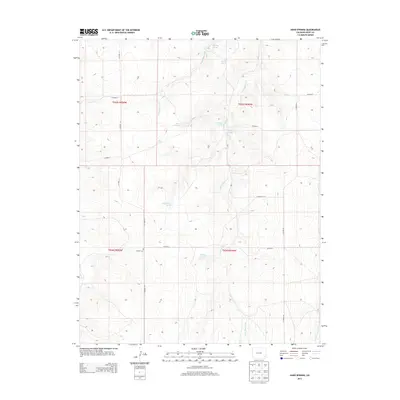
2013 Map of Hand Springs
USGS Topo · Published 2013About this map
Antelope Creek and its surrounding drainage systems define the high plains landscape of southern Bent County in this early 21st-century survey. The area is characterized by a sparse network of county roads, such as CO Road 23 and CO Road 28, that cross a terrain etched by seasonal water sources and named springs. These reliable water points, including Hand Springs, Santastevens Spring, and Medford Spring, represent the essential geography of this arid environment, likely serving as historic landmarks for ranching operations and early travelers.
Find a feature on this map
23 named features on this map. Tap any name to fly to it.
Don’t see what you’re looking for? This feature index may not catch every label — zoom into the map to look around manually.
Map Details
Editions of this 2013 Hand Springs Map
This is the sole edition of this map. No revisions or reprints were ever made.
Other maps of this area

1891 · Higbee
USGS Topo · 1:125,000

1892 · Two Butte
USGS Topo · 1:125,000

1893 · Higbee
USGS Topo · 1:125,000

1893 · Two Butte
USGS Topo · 1:125,000

1955 · La Junta
USGS Topo · 1:250,000

1958 · La Junta
USGS Topo · 1:250,000

1966 · Toonerville SE
USGS Topo · 1:24,000
1966 · Toonerville NE
USGS Topo · 1:24,000

1967 · Hand Springs
USGS Topo · 1:24,000

1968 · La Junta
USGS Topo · 1:250,000