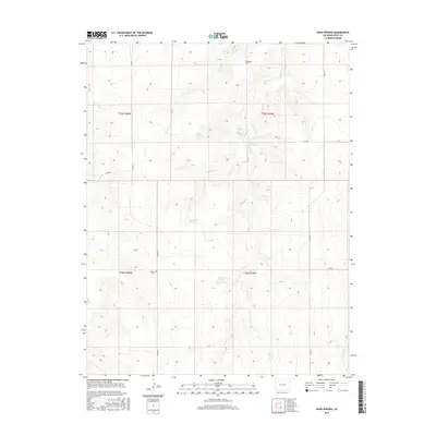
2016 Map of Hand Springs
USGS Topo · Published 2016About this map
Antelope Cr and W Mud Cr define the drainage patterns of this southeastern Colorado landscape, where water sources are vital geographic markers. The presence of Antelope School and the Bethel Cem indicates a rural community structure organized around these seasonal watercourses and the section-line roads that cross the high plains. Numerous named water sources, including Hand Springs, Santastevens Spring, and Medford Spring, are scattered throughout the quadrangle, serving as essential landmarks for ranchers and early settlers in this arid region. The mapping of Chimney Spring and Box Springs further emphasizes the importance of these localized hydrographic features within the expansive township and range grid system.
Find a feature on this map
22 named features on this map. Tap any name to fly to it.
Don’t see what you’re looking for? This feature index may not catch every label — zoom into the map to look around manually.
Map Details
Editions of this 2016 Hand Springs Map
This is the sole edition of this map. No revisions or reprints were ever made.
Other maps of this area

1891 · Higbee
USGS Topo · 1:125,000

1892 · Two Butte
USGS Topo · 1:125,000

1893 · Higbee
USGS Topo · 1:125,000

1893 · Two Butte
USGS Topo · 1:125,000

1955 · La Junta
USGS Topo · 1:250,000

1958 · La Junta
USGS Topo · 1:250,000

1966 · Toonerville SE
USGS Topo · 1:24,000
1966 · Toonerville NE
USGS Topo · 1:24,000

1967 · Hand Springs
USGS Topo · 1:24,000

1968 · La Junta
USGS Topo · 1:250,000