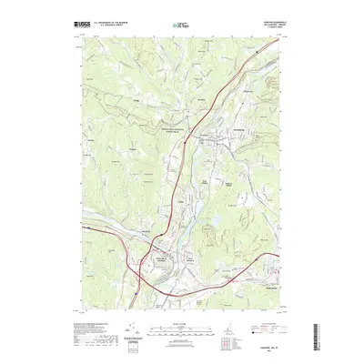
2021 Map of Hanover
USGS Topo · Published 2021About this map
The Connecticut River serves as the primary artery through this Upper Valley corridor, marking the state line where White River Junction and Hartford meet West Lebanon and Hanover. The landscape is a hub of education and transport, anchored by the campus of Dartmouth College and the southern activity of the Lebanon Municipal Airport. This modern survey details a densely layered geography of local history, including over a dozen burial grounds such as Sacred Heart Cem, Mount Olivet Cem, and the Christian Street Cem.
Find a feature on this map
103 named features on this map. Tap any name to fly to it.
Don’t see what you’re looking for? This feature index may not catch every label — zoom into the map to look around manually.
Map Details
Editions of this 2021 Hanover Map
This is the sole edition of this map. No revisions or reprints were ever made.
Other maps of this area

1896 · Strafford
USGS Topo · 1:62,500

1906 · Hanover
USGS Topo · 1:62,500

1908 · Hanover
USGS Topo · 1:62,500

1927 · Mascoma
USGS Topo · 1:62,500

1931 · Mt. Cube
USGS Topo · 1:62,500

1932 · Mascoma
USGS Topo · 1:62,500

1933 · Mt. Cube
USGS Topo · 1:62,500

1944 · Strafford
USGS Topo · 1:62,500

1950 · Glens Falls
USGS Topo · 1:250,000

1956 · Glens Falls
USGS Topo · 1:250,000