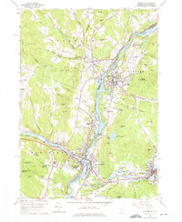
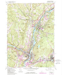
1959 Map of Hanover
USGS Topo · Published 1975About this map
The Connecticut River serves as the primary artery of this mid-century landscape, defining the state boundary between Norwich, Vermont, and Hanover, New Hampshire. The twin collegiate and commercial hubs of the Upper Valley are shown just as postwar development began to expand away from the traditional village centers. In Vermont, the Boston and Maine Railroad corridors follow the riverbanks, supporting the industrial activity at White River Junction where the White River meets the Connecticut.
Find a feature on this map
89 named features on this map. Tap any name to fly to it.
Don’t see what you’re looking for? This feature index may not catch every label — zoom into the map to look around manually.
Map Details
Editions of this 1959 Hanover Map
5 editions found
Other maps of this area

1896 · Strafford
USGS Topo · 1:62,500

1906 · Hanover
USGS Topo · 1:62,500

1908 · Hanover
USGS Topo · 1:62,500

1927 · Mascoma
USGS Topo · 1:62,500

1931 · Mt. Cube
USGS Topo · 1:62,500

1932 · Mascoma
USGS Topo · 1:62,500

1933 · Mt. Cube
USGS Topo · 1:62,500

1944 · Strafford
USGS Topo · 1:62,500

1950 · Glens Falls
USGS Topo · 1:250,000

1956 · Glens Falls
USGS Topo · 1:250,000