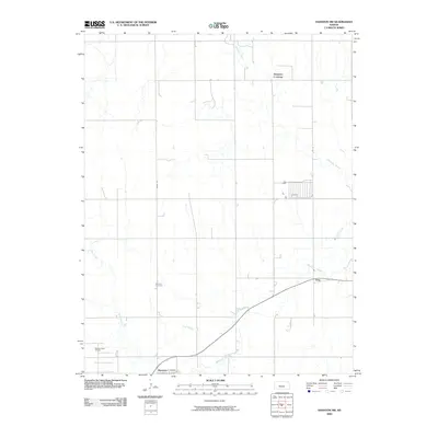
2009 Map of Hanston NW
USGS Topo · Published 2009About this map
Buckner Creek and its various tributaries, including several stretches of Dry Creek, define this rural Hodgeman County landscape. The mapping focuses on the agrarian and industrial infrastructure north and west of the town of Hanston. Settlement is concentrated along the southern edge of the quadrangle, where Lincoln St and the community of Gray are situated near the waterway.
Find a feature on this map
10 named features on this map. Tap any name to fly to it.
Don’t see what you’re looking for? This feature index may not catch every label — zoom into the map to look around manually.
Map Details
Editions of this 2009 Hanston NW Map
This is the sole edition of this map. No revisions or reprints were ever made.
Other maps of this area

1892 · Ness
USGS Topo · 1:125,000

1894 · Ness
USGS Topo · 1:125,000

1955 · Great Bend
USGS Topo · 1:250,000

1957 · Great Bend
USGS Topo · 1:250,000

1958 · Great Bend
USGS Topo · 1:250,000

1970 · Jetmore SE
USGS Topo · 1:24,000
1970 · Hanston
USGS Topo · 1:24,000

1970 · Hanston NW
USGS Topo · 1:24,000

1970 · Jetmore NE
USGS Topo · 1:24,000
1970 · Burdett
USGS Topo · 1:24,000