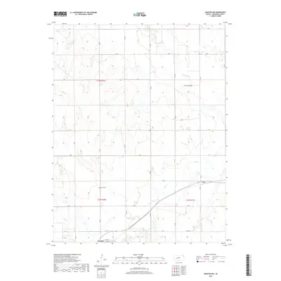
2018 Map of Hanston NW
USGS Topo · Published 2018About this map
The town of Hanston serves as a small hub at the southern edge of this Hodgeman County landscape, where the local grid is defined by streets like Lincoln St and Adams St. The topography is shaped by the winding courses of the Pawnee River in the north and the converging waters of Buckner Cr and Dry Cr to the south. These waterways carve subtle relief into the High Plains, dictating the placement of early road corridors such as P Rd and Garfield Rd.
Find a feature on this map
21 named features on this map. Tap any name to fly to it.
Don’t see what you’re looking for? This feature index may not catch every label — zoom into the map to look around manually.
Map Details
Editions of this 2018 Hanston NW Map
This is the sole edition of this map. No revisions or reprints were ever made.
Other maps of this area

1892 · Ness
USGS Topo · 1:125,000

1894 · Ness
USGS Topo · 1:125,000

1955 · Great Bend
USGS Topo · 1:250,000

1957 · Great Bend
USGS Topo · 1:250,000

1958 · Great Bend
USGS Topo · 1:250,000

1970 · Jetmore SE
USGS Topo · 1:24,000
1970 · Hanston
USGS Topo · 1:24,000

1970 · Hanston NW
USGS Topo · 1:24,000

1970 · Jetmore NE
USGS Topo · 1:24,000
1970 · Burdett
USGS Topo · 1:24,000