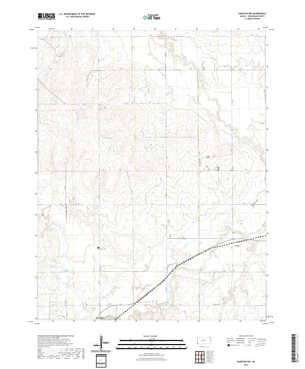
2022 Map of Hanston NW
USGS Topo · Published 2022About this map
Pawnee River meanders through the northern reaches of this Hodgeman County landscape, defining a terrain shaped by the intermittent waterways of the High Plains. The southern portion of the sheet is anchored by the community of Hanston, situated near the confluence of local drainages like Buckner Cr and Dry Cr. This area reflects the transition from river bottomlands to the section-line grid typical of Kansas agricultural development, where roads like Garfield Rd and P Rd carve out the prairie into precise townships. For those researching local history, the Hanston Cem and the location of Gray provide specific points of reference within the rural landscape. The map illustrates how late-20th-century infrastructure, including State Highway 156, follows the natural contours of the creek valleys to connect these remote prairie settlements.
Find a feature on this map
21 named features on this map. Tap any name to fly to it.
Don’t see what you’re looking for? This feature index may not catch every label — zoom into the map to look around manually.
Map Details
Editions of this 2022 Hanston NW Map
This is the sole edition of this map. No revisions or reprints were ever made.
Other maps of this area

1892 · Ness
USGS Topo · 1:125,000

1894 · Ness
USGS Topo · 1:125,000

1955 · Great Bend
USGS Topo · 1:250,000

1957 · Great Bend
USGS Topo · 1:250,000

1958 · Great Bend
USGS Topo · 1:250,000

1970 · Jetmore SE
USGS Topo · 1:24,000
1970 · Hanston
USGS Topo · 1:24,000

1970 · Hanston NW
USGS Topo · 1:24,000

1970 · Jetmore NE
USGS Topo · 1:24,000
1970 · Burdett
USGS Topo · 1:24,000