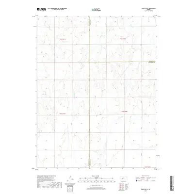
2018 Map of Hanston SE
USGS Topo · Published 2018About this map
Sawmill Cr winds through the expansive prairie of south-central Kansas, serving as the primary hydrological feature in this rural landscape where Pawnee, Hodgeman, and Edwards counties meet. This 2018 survey documents a strictly agricultural grid, defined by an orderly network of section-line roads such as N Rd, K Rd, and Co Rd 7. The land is meticulously partitioned into townships, including t22s r20w and t23s r21w, reflecting the enduring legacy of the Public Land Survey System. The lack of concentrated settlements or industrial infrastructure emphasizes the region's dedication to large-scale ranching or dryland farming. These named county roads provide the essential framework for navigating the subtle drainage patterns that feed into the local creek system, offering a clear record of modern rural land management and property division in the High Plains.
Find a feature on this map
20 named features on this map. Tap any name to fly to it.
Don’t see what you’re looking for? This feature index may not catch every label — zoom into the map to look around manually.
Map Details
Editions of this 2018 Hanston SE Map
This is the sole edition of this map. No revisions or reprints were ever made.
Other maps of this area

1889 · Larned
USGS Topo · 1:125,000

1889 · Kinsley
USGS Topo · 1:125,000

1891 · Larned
USGS Topo · 1:125,000

1892 · Ness
USGS Topo · 1:125,000

1892 · Kinsley
USGS Topo · 1:125,000

1892 · Spearville
USGS Topo · 1:125,000

1894 · Spearville
USGS Topo · 1:125,000

1894 · Kinsley
USGS Topo · 1:125,000

1894 · Ness
USGS Topo · 1:125,000

1955 · Great Bend
USGS Topo · 1:250,000