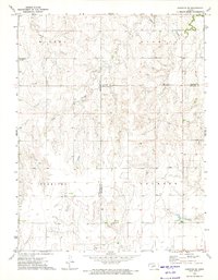
1972 Map of Hanston SE
USGS Topo · Published 1974About this map
Sawmill Creek meanders through this agricultural landscape in the early 1970s, where the high plains of western Kansas are organized into large townships. The map documents rural divisions including Marena, Sawmill, Sterling, and Jackson, reflecting the cadastral history of the region. This period shows a transition toward energy extraction and infrastructure, evidenced by the presence of a Gas Well and a Radio Tower BM 2293. The terrain is marked by the distinct boundary intersections of Hodgeman, Pawnee, and Edwards counties. Local resource use is noted by a Caliche Pit, a detail of interest to those studying historical land use and geological extraction in the area. The network of section lines and primitive roads illustrates the enduring structure of the Kansas prairie survey system.
Find a feature on this map
11 named features on this map. Tap any name to fly to it.
Don’t see what you’re looking for? This feature index may not catch every label — zoom into the map to look around manually.
Map Details
Editions of this 1972 Hanston SE Map
This is the sole edition of this map. No revisions or reprints were ever made.
Other maps of this area

1889 · Larned
USGS Topo · 1:125,000

1889 · Kinsley
USGS Topo · 1:125,000

1891 · Larned
USGS Topo · 1:125,000

1892 · Ness
USGS Topo · 1:125,000

1892 · Kinsley
USGS Topo · 1:125,000

1892 · Spearville
USGS Topo · 1:125,000

1894 · Spearville
USGS Topo · 1:125,000

1894 · Kinsley
USGS Topo · 1:125,000

1894 · Ness
USGS Topo · 1:125,000

1955 · Great Bend
USGS Topo · 1:250,000