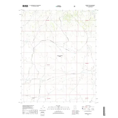
2018 Map of Harbison Tank
USGS Topo · Published 2018About this map
Kaibab National Forest dominates this northern Arizona landscape, defined by a network of historic trails and essential water management features. The area serves as a significant crossroads for long-distance trekking, where the Arizona National Scenic Trail and the Great Western Trail traverse the high-desert terrain. The presence of numerous named catchments, such as Hupmobile Tank, Old Automobile Tank, and New Automobile Tank, suggests a specific era of local nomenclature tied to early twentieth-century motoring or ranching infrastructure.
Find a feature on this map
32 named features on this map. Tap any name to fly to it.
Don’t see what you’re looking for? This feature index may not catch every label — zoom into the map to look around manually.
Map Details
Editions of this 2018 Harbison Tank Map
This is the sole edition of this map. No revisions or reprints were ever made.
Other maps of this area

1886 · San Francisco Mtns
USGS Topo · 1:250,000

1886 · Chino
USGS Topo · 1:250,000

1891 · San Francisco Mtns
USGS Topo · 1:250,000

1891 · Chino
USGS Topo · 1:250,000

1894 · San Francisco Mtns
USGS Topo · 1:250,000

1899 · San Francisco Mtns
USGS Topo · 1:250,000

1947 · Flagstaff
USGS Topo · 1:250,000

1948 · Williams
USGS Topo · 1:250,000

1954 · Flagstaff
USGS Topo · 1:250,000

1954 · Williams
USGS Topo · 1:250,000