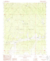
1989 Map of Harbison Tank
USGS Topo · Published 1989About this map
Kaibab National Forest defines the landscape of this high-plateau region in northern Arizona, where water management is central to the land's utility. The map reveals a sophisticated network of earthen stock tanks and drainage washes, reflecting the ranching heritage of Coconino County. Unique nomenclature like Old Automobile Tank, New Automobile Tank, and Hupmobile Tank suggests the era when motor travel first began to influence these more isolated reaches. Beyond these water features, the terrain is marked by significant drainages such as Blue Stem Wash and Red Horse Wash, which navigate the elevation changes. A single Landing Strip provides a small footprint of modern infrastructure within this predominantly rural and protected forest environment, showing how the region was accessed and monitored in the late 1980s.
Find a feature on this map
21 named features on this map. Tap any name to fly to it.
Don’t see what you’re looking for? This feature index may not catch every label — zoom into the map to look around manually.
Map Details
Editions of this 1989 Harbison Tank Map
This is the sole edition of this map. No revisions or reprints were ever made.
Other maps of this area

1886 · San Francisco Mtns
USGS Topo · 1:250,000

1886 · Chino
USGS Topo · 1:250,000

1891 · San Francisco Mtns
USGS Topo · 1:250,000

1891 · Chino
USGS Topo · 1:250,000

1894 · San Francisco Mtns
USGS Topo · 1:250,000

1899 · San Francisco Mtns
USGS Topo · 1:250,000

1947 · Flagstaff
USGS Topo · 1:250,000

1948 · Williams
USGS Topo · 1:250,000

1954 · Flagstaff
USGS Topo · 1:250,000

1954 · Williams
USGS Topo · 1:250,000