2022 Map of Hardin
USGS Topo · Published 2022About this map
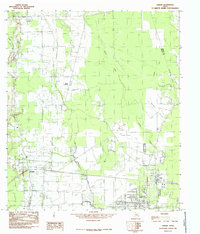
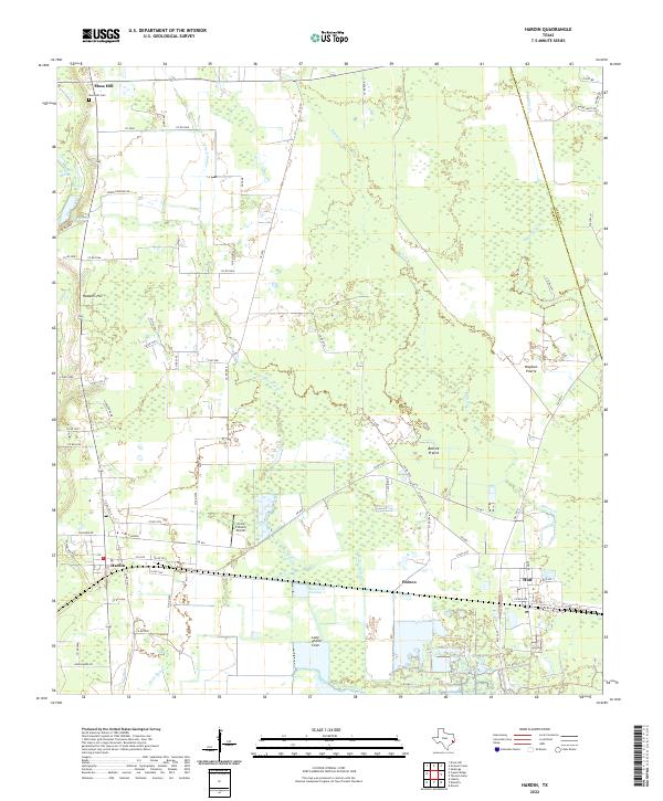
Low-lying prairie and marshland define the landscape of south-central Liberty County, where the sprawling drainage systems of Batiste Cr and Long Island Cr weave through a network of rural settlements. The map centers on the community of Hardin and the surrounding unincorporated areas of Pedeco and Hull. Evidence of the region's agricultural and transit history is visible in the placement of Mayhaw Prairie and Batiste Prairie, alongside the localized infrastructure of the Circle C Ranch Airport.
Find a feature on this map
76 named features on this map. Tap any name to fly to it.
Don’t see what you’re looking for? This feature index may not catch every label — zoom into the map to look around manually.
Map Details
Editions of this 2022 Hardin Map
This is the sole edition of this map. No revisions or reprints were ever made.