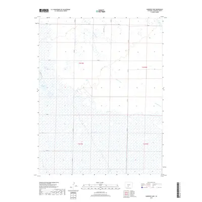
2019 Map of Harrence Lake
USGS Topo · Published 2019About this map
The expansive high plains of Saguache County are defined by a complex network of seasonal drainage and wetlands in this 2019 survey. Harrence Lake sits at the center of a wide hydrological basin, where ephemeral watercourses like Werner Arroyo and Russell Cr navigate the flat, open terrain. This landscape is a patchwork of public land survey sections, with the township lines of t43n r8e and t43n r9e providing the primary structure for the rural road network. Local routes such as Co RD T and San Juan Ln cross the northern reaches of the quadrangle, reflecting the sparse, wide-open character of this part of the San Luis Valley. In the southern sections, the path of La Garita Cr cuts through the marshy ground, illustrating the subtle elevation changes that direct the flow of water across this high-altitude environment.
Find a feature on this map
20 named features on this map. Tap any name to fly to it.
Don’t see what you’re looking for? This feature index may not catch every label — zoom into the map to look around manually.
Map Details
Editions of this 2019 Harrence Lake Map
This is the sole edition of this map. No revisions or reprints were ever made.
Other maps of this area

1915 · Del Norte
USGS Topo · 1:125,000

1917 · Del Norte
USGS Topo · 1:125,000

1945 · Durango
USGS Topo · 1:250,000

1953 · Durango
USGS Topo · 1:250,000

1954 · Durango
USGS Topo · 1:250,000

1954 · Trinidad
USGS Topo · 1:250,000

1954 · Pueblo
USGS Topo · 1:250,000

1955 · Trinidad
USGS Topo · 1:250,000

1956 · Montrose
USGS Topo · 1:250,000

1957 · Pueblo
USGS Topo · 1:250,000