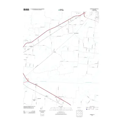
2013 Map of Harris
USGS Topo · Published 2013About this map
The North Fork Obion River meanders across the southern portion of this landscape, anchoring a rural Tennessee region defined by small, historically agricultural clusters. Long-established communities such as Harris, Pierce Station, and Chambers dot the corridor north of the river, while the modern aviation facilities at Everett-Stewart Regional Airport occupy the southwest corner near Sunnyside. The road network is marked by numerous family-named routes, including Taylor Brothers Rd and Albert Owens Rd, which hint at decades of local landownership and hereditary farming. Water drainage patterns are primarily dictated by the Harris Fork Cr and Deer Cr, which feed into the river system. This area, situated in the northwestern corner of the state, maintains its character through a collection of small hamlets like Terrell, Midway, and Shofner, illustrating the persistent settlement patterns of rural Obion County.
Find a feature on this map
87 named features on this map. Tap any name to fly to it.
Don’t see what you’re looking for? This feature index may not catch every label — zoom into the map to look around manually.
Map Details
Editions of this 2013 Harris Map
This is the sole edition of this map. No revisions or reprints were ever made.
Other maps of this area

1939 · Hickman
USGS Topo · 1:62,500

1950 · Martin
USGS Topo · 1:24,000

1950 · Rives
USGS Topo · 1:24,000

1951 · Rives
USGS Topo · 1:24,000

1951 · Cayce
USGS Topo · 1:24,000

1952 · Crutchfield
USGS Topo · 1:24,000

1952 · Water Valley
USGS Topo · 1:24,000

1952 · Water Valley
USGS Topo · 1:62,500

1954 · Union City
USGS Topo · 1:24,000

1954 · Hickman
USGS Topo · 1:62,500