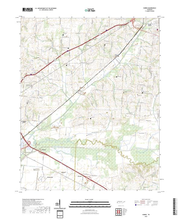
2022 Map of Harris
USGS Topo · Published 2022About this map
The North Fork Obion River meanders through the southern portion of this landscape, marking the boundary between Obion and Weakley counties. This rural corridor is defined by small, historically rooted settlements such as Harris, Pierce Station, and Shofner, which are linked by a network of country roads including Chapel Hill Rd and Mc Connell Rd. The distribution of family-named burial grounds across the farmland—including the Morris Slave Cem, Murphey Cem, and Johnson Grove Cem—points to generations of agricultural settlement and complex social histories in the region north of Union City.
Find a feature on this map
89 named features on this map. Tap any name to fly to it.
Don’t see what you’re looking for? This feature index may not catch every label — zoom into the map to look around manually.
Map Details
Editions of this 2022 Harris Map
This is the sole edition of this map. No revisions or reprints were ever made.
Other maps of this area

1939 · Hickman
USGS Topo · 1:62,500

1950 · Martin
USGS Topo · 1:24,000

1950 · Rives
USGS Topo · 1:24,000

1951 · Rives
USGS Topo · 1:24,000

1951 · Cayce
USGS Topo · 1:24,000

1952 · Crutchfield
USGS Topo · 1:24,000

1952 · Water Valley
USGS Topo · 1:24,000

1952 · Water Valley
USGS Topo · 1:62,500

1954 · Union City
USGS Topo · 1:24,000

1954 · Hickman
USGS Topo · 1:62,500