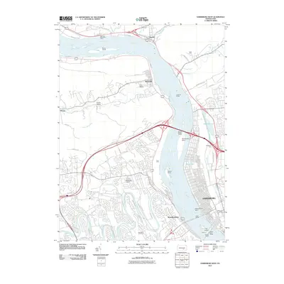
2010 Map of Harrisburg West
USGS Topo · Published 2010About this map
Enola Yards dominates the western bank of the Susquehanna River, serving as a massive rail hub that anchors the industrial identity of this river corridor. Across the water, the northwestern outskirts of Harrisburg are marked by significant landmarks like the Wildwood Dam and Italian Lake, while the iconic Rockville Bridge spans the river toward Marysville. The map details the transition from the dense urban grid of the state capital to the winding residential roads and high ridges to the north.
Find a feature on this map
64 named features on this map. Tap any name to fly to it.
Don’t see what you’re looking for? This feature index may not catch every label — zoom into the map to look around manually.
Map Details
Editions of this 2010 Harrisburg West Map
This is the sole edition of this map. No revisions or reprints were ever made.
Other maps of this area

1892 · Harrisburg
USGS Topo · 1:62,500

1899 · Harrisburg
USGS Topo · 1:62,500

1904 · Carlisle
USGS Topo · 1:62,500

1906 · New Cumberland
USGS Topo · 1:62,500

1907 · New Bloomfield
USGS Topo · 1:62,500

1924 · Harrisburg
USGS Topo · 1:62,500

1943 · New Cumberland
USGS Topo · 1:62,500

1943 · Harrisburg
USGS Topo · 1:62,500

1943 · New Bloomfield
USGS Topo · 1:62,500

1943 · Carlisle
USGS Topo · 1:62,500
Featured Places
- Harrisburg, PA
- Enola, East Pennsboro Township
- Wormleysburg, PA
- West Fairview, East Pennsboro Township
- Dauphin, PA