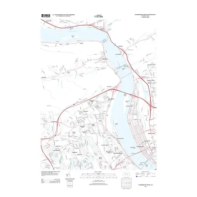
2013 Map of Harrisburg West
USGS Topo · Published 2013About this map
The Susquehanna River dominates this landscape, its wide channel punctuated by substantial landforms like Berrier Island and McCormicks Island. Along its banks, the infrastructure of the rail and river economy is evident in the sprawling Enola Yards and the massive Rockville Bridge, which serves as a vital crossing point north of the capital. The west bank is characterized by a series of established communities including Marysville, Enola, and West Fairview, while the northern reaches feature the Water Gap Observation Tower overlooking the river's path through the gap.
Find a feature on this map
127 named features on this map. Tap any name to fly to it.
Don’t see what you’re looking for? This feature index may not catch every label — zoom into the map to look around manually.
Map Details
Editions of this 2013 Harrisburg West Map
This is the sole edition of this map. No revisions or reprints were ever made.
Other maps of this area

1892 · Harrisburg
USGS Topo · 1:62,500

1899 · Harrisburg
USGS Topo · 1:62,500

1904 · Carlisle
USGS Topo · 1:62,500

1906 · New Cumberland
USGS Topo · 1:62,500

1907 · New Bloomfield
USGS Topo · 1:62,500

1924 · Harrisburg
USGS Topo · 1:62,500

1943 · New Cumberland
USGS Topo · 1:62,500

1943 · Harrisburg
USGS Topo · 1:62,500

1943 · New Bloomfield
USGS Topo · 1:62,500

1943 · Carlisle
USGS Topo · 1:62,500
Featured Places
- Harrisburg, PA
- Enola, East Pennsboro Township
- Wormleysburg, PA
- West Fairview, East Pennsboro Township
- Dauphin, PA