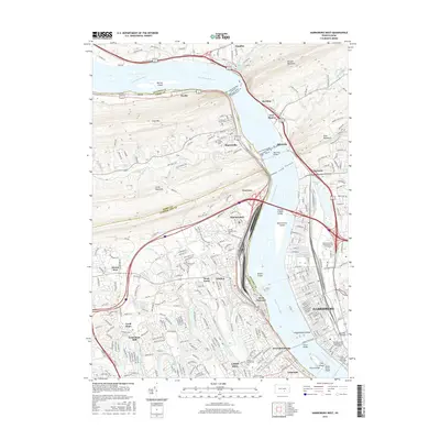
2016 Map of Harrisburg West
USGS Topo · Published 2016About this map
Harrisburg and its western suburbs define this mid-2010s landscape where the Susquehanna River cuts through the ridges of the Appalachian Mountains. The map illustrates a dense corridor of transportation and industry, from the sprawling railyards at Enola to the iconic Rockville Bridge connecting the riverbanks. To the north, the terrain rises sharply into Cove Mtn and Second Mountain, framing the river gaps at Dauphin and Fort Hunter.
Find a feature on this map
282 named features on this map. Tap any name to fly to it.
Don’t see what you’re looking for? This feature index may not catch every label — zoom into the map to look around manually.
Map Details
Editions of this 2016 Harrisburg West Map
This is the sole edition of this map. No revisions or reprints were ever made.
Other maps of this area

1892 · Harrisburg
USGS Topo · 1:62,500

1899 · Harrisburg
USGS Topo · 1:62,500

1904 · Carlisle
USGS Topo · 1:62,500

1906 · New Cumberland
USGS Topo · 1:62,500

1907 · New Bloomfield
USGS Topo · 1:62,500

1924 · Harrisburg
USGS Topo · 1:62,500

1943 · New Cumberland
USGS Topo · 1:62,500

1943 · Harrisburg
USGS Topo · 1:62,500

1943 · New Bloomfield
USGS Topo · 1:62,500

1943 · Carlisle
USGS Topo · 1:62,500
Featured Places
- Harrisburg, PA
- Enola, East Pennsboro Township
- Wormleysburg, PA
- West Fairview, East Pennsboro Township
- Dauphin, PA