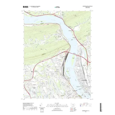
2019 Map of Harrisburg West
USGS Topo · Published 2019About this map
The Susquehanna River dominates this landscape, serving as a massive natural boundary between the riverfront communities of Harrisburg, Lemoyne, and Wormleysburg on the east and the climbing terrain of Cove Mtn to the west. Several large islands, including McCormicks Island and City Island, break the river's flow near the many bridges that connect the growing suburbs. To the south, the winding Conodoguinet Creek meanders through Camp Hill and Good Hope, where Good Hope Mill stands as a point of local interest. This 2019 survey documents a densely developed region where modern infrastructure, such as the Pennsylvania Judicial Center, sits alongside older heritage sites like the Harris Burial Ground and the Mount Zion United Methodist Church. The map effectively shows how the steep ridgelines of Blue Mountain and Second Mountain have funneled transit and settlement along the river corridor.
Find a feature on this map
130 named features on this map. Tap any name to fly to it.
Don’t see what you’re looking for? This feature index may not catch every label — zoom into the map to look around manually.
Map Details
Editions of this 2019 Harrisburg West Map
This is the sole edition of this map. No revisions or reprints were ever made.
Other maps of this area

1892 · Harrisburg
USGS Topo · 1:62,500

1899 · Harrisburg
USGS Topo · 1:62,500

1904 · Carlisle
USGS Topo · 1:62,500

1906 · New Cumberland
USGS Topo · 1:62,500

1907 · New Bloomfield
USGS Topo · 1:62,500

1924 · Harrisburg
USGS Topo · 1:62,500

1943 · New Cumberland
USGS Topo · 1:62,500

1943 · Harrisburg
USGS Topo · 1:62,500

1943 · New Bloomfield
USGS Topo · 1:62,500

1943 · Carlisle
USGS Topo · 1:62,500
Featured Places
- Harrisburg, PA
- Enola, East Pennsboro Township
- Wormleysburg, PA
- West Fairview, East Pennsboro Township
- Dauphin, PA