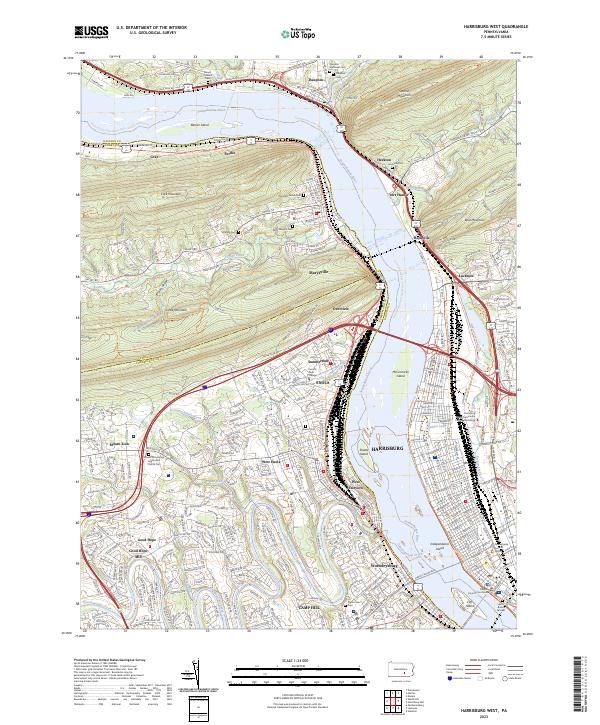
2023 Map of Harrisburg West
USGS Topo · Published 2023About this map
The Susquehanna River dominates this Pennsylvania landscape, carving a wide path through the gaps in Blue Mountain and Cove Mountain. On the west bank, the massive rail infrastructure at Enola and West Enola reflects the region's enduring role as a transportation hub, where the Norfolk Southern lines parallel the river. The map details the developed riverfronts of Wormleysburg and West Fairview directly across from the state capital's downtown core, including Independence Island and City Island.
Find a feature on this map
72 named features on this map. Tap any name to fly to it.
Don’t see what you’re looking for? This feature index may not catch every label — zoom into the map to look around manually.
Map Details
Editions of this 2023 Harrisburg West Map
This is the sole edition of this map. No revisions or reprints were ever made.
Other maps of this area

1892 · Harrisburg
USGS Topo · 1:62,500

1899 · Harrisburg
USGS Topo · 1:62,500

1904 · Carlisle
USGS Topo · 1:62,500

1906 · New Cumberland
USGS Topo · 1:62,500

1907 · New Bloomfield
USGS Topo · 1:62,500

1924 · Harrisburg
USGS Topo · 1:62,500

1943 · New Cumberland
USGS Topo · 1:62,500

1943 · Harrisburg
USGS Topo · 1:62,500

1943 · New Bloomfield
USGS Topo · 1:62,500

1943 · Carlisle
USGS Topo · 1:62,500
Featured Places
- Harrisburg, PA
- Enola, East Pennsboro Township
- Wormleysburg, PA
- West Fairview, East Pennsboro Township
- Dauphin, PA