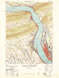
1947 Map of Harrisburg West
USGS Topo · Published 1947About this map
The Susquehanna River dominates this mid-century landscape, carving a deep path through the massive ridges of Second Mountain, Cove Mountain, and Blue Mountain. The state’s capital region is shown during a period of significant post-war infrastructure, anchored by the State Capitol and the sprawling Railroad Yard at Enola. The map captures the complex rail-and-river geography of the area, featuring the massive Rockville Bridge connecting the east and west banks.
Find a feature on this map
54 named features on this map. Tap any name to fly to it.
Don’t see what you’re looking for? This feature index may not catch every label — zoom into the map to look around manually.
Map Details
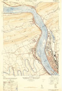
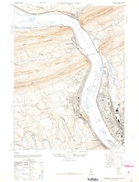
Editions of this 1947 Harrisburg West Map
3 editions found
Other maps of this area

1892 · Harrisburg
USGS Topo · 1:62,500

1899 · Harrisburg
USGS Topo · 1:62,500

1904 · Carlisle
USGS Topo · 1:62,500

1906 · New Cumberland
USGS Topo · 1:62,500

1907 · New Bloomfield
USGS Topo · 1:62,500

1924 · Harrisburg
USGS Topo · 1:62,500

1943 · New Cumberland
USGS Topo · 1:62,500

1943 · Harrisburg
USGS Topo · 1:62,500

1943 · New Bloomfield
USGS Topo · 1:62,500

1943 · Carlisle
USGS Topo · 1:62,500
Featured Places
- Harrisburg, PA
- Enola, East Pennsboro Township
- Wormleysburg, PA
- West Fairview, East Pennsboro Township
- Dauphin, PA