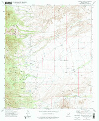
1972 Map of Harrison Canyon
USGS Topo · Published 1975About this map
Coronado National Forest and the Galiuro Mountains dominate this 1970s landscape in Graham County, showcasing a network of seasonal water management and rugged topography. The survey reveals a complex system of livestock and water infrastructure essential to the arid region, featuring numerous named "tanks" such as Hurry Up Tank, Lane Tank, and Little Full Tank. These features, alongside ranching landmarks like the McGee Windmill, indicate the ranching heritage of the area south of Aravaipa Canyon.
Find a feature on this map
30 named features on this map. Tap any name to fly to it.
Don’t see what you’re looking for? This feature index may not catch every label — zoom into the map to look around manually.
Map Details
Editions of this 1972 Harrison Canyon Map
2 editions found
Other maps of this area

1938 · Galiuro Mts
USGS Topo · 1:48,000

1940 · Sierra Bonita Ranch
USGS Topo · 1:62,500

1942 · Sierra Bonita Ranch
USGS Topo · 1:62,500

1943 · Galiuro Mts
USGS Topo · 1:62,500

1943 · Sierra Bonita Ranch
USGS Topo · 1:62,500

1943 · Winchester Mts.
USGS Topo · 1:62,500

1945 · Redington
USGS Topo · 1:62,500

1945 · Winchester Mts.
USGS Topo · 1:62,500

1956 · Tucson
USGS Topo · 1:250,000

1957 · Redington
USGS Topo · 1:62,500