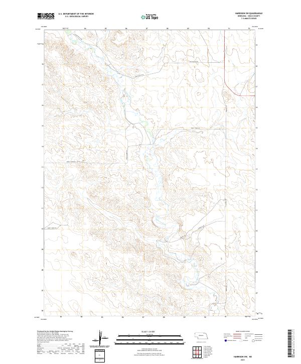
2021 Map of Harrison SW
USGS Topo · Published 2021About this map
The Niobrara River carves a winding path across this portion of Sioux County, Nebraska, defining the topography of this high plains landscape. This modern survey illustrates the persistent ranching and agricultural framework of the region, where water management is visible through features like the Lakotah Canal. The township and range lines, including t30n r56w and t31n r57w, provide the underlying structure for the sectioned land parcels characteristic of the American West. Movement through this sparsely populated area is facilitated by a network of local thoroughfares such as Morrill Rd, Circle Butte Rd, and Merrill Rd. These routes connect the expansive rangelands and help document the modern road naming conventions in a county known for its open vistas and large-scale cattle operations.
Find a feature on this map
12 named features on this map. Tap any name to fly to it.
Don’t see what you’re looking for? This feature index may not catch every label — zoom into the map to look around manually.
Map Details
Editions of this 2021 Harrison SW Map
This is the sole edition of this map. No revisions or reprints were ever made.
Other maps of this area

1896 · Patrick
USGS Topo · 1:125,000

1899 · Whistle Creek
USGS Topo · 1:125,000

1954 · Torrington
USGS Topo · 1:250,000

1955 · Alliance
USGS Topo · 1:250,000

1957 · Alliance
USGS Topo · 1:250,000

1958 · Torrington
USGS Topo · 1:250,000

1958 · Alliance
USGS Topo · 1:250,000

1977 · Van Tassell
USGS Topo · 1:24,000

1977 · Van Tassell SE
USGS Topo · 1:24,000
1978 · Torrington
USGS Topo · 1:100,000