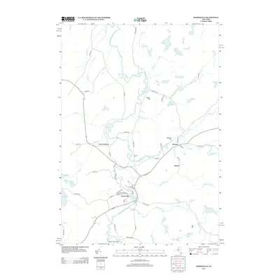
2013 Map of Harrisville
USGS Topo · Published 2013About this map
Harrisville serves as the primary hub of activity in this Adirondack-fringe landscape, situated along the W Br Oswegatchie River where local streets like Mill St and Railroad St hint at the village’s industrial history. The surrounding countryside is defined by a dense network of water bodies and high points, from the large expanse of Lake Bonaparte to the prominent heights of Cooper Hill and Baldface Hill. Smaller clusters of settlement are found at Pitcairn, Backus, and Geers Corners, linked by rural routes such as Alpine Rd and Co Rte-26. Genealogists and local historians can locate the Garrison Cem along Garrison Rd, while numerous ponds like Duck Pond, Bullhead Pond, and Shiner Pond illustrate the glacial geography characteristic of northern New York. The map details a transition from the structured street grid of the village to the meandering paths of Toothaker Cr and Meadow Brook.
Find a feature on this map
73 named features on this map. Tap any name to fly to it.
Don’t see what you’re looking for? This feature index may not catch every label — zoom into the map to look around manually.
Map Details
Editions of this 2013 Harrisville Map
This is the sole edition of this map. No revisions or reprints were ever made.
Other maps of this area

1913 · Lake Bonaparte
USGS Topo · 1:62,500

1915 · Gouverneur
USGS Topo · 1:62,500

1915 · Russell
USGS Topo · 1:62,500

1916 · Lake Bonaparte
USGS Topo · 1:62,500

1916 · Oswegatchie
USGS Topo · 1:62,500

1918 · Russell
USGS Topo · 1:62,500

1918 · Oswegatchie
USGS Topo · 1:62,500

1937 · Gouverneur
USGS Topo · 1:62,500

1948 · Ogdensburg
USGS Topo · 1:250,000

1951 · Ogdensburg
USGS Topo · 1:250,000