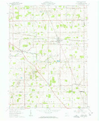
1961 Map of Harrod
USGS Topo · Published 1963About this map
The Auglaize River meanders through this portion of Allen and Auglaize Counties, providing a natural centerpiece for a landscape defined by organized rural settlement and early 1960s infrastructure. The Erie Lackawanna railroad cuts a straight path east-to-west, serving the village of Harrod and the rail station at Westminster. This era shows a community deeply rooted in its local institutions, evidenced by the high density of country churches and family-named cemeteries such as Heidelberg Ch, Auglaize Ch, and Salem Cem.
Find a feature on this map
72 named features on this map. Tap any name to fly to it.
Don’t see what you’re looking for? This feature index may not catch every label — zoom into the map to look around manually.
Map Details
Editions of this 1961 Harrod Map
2 editions found
Other maps of this area

1906 · Lima
USGS Topo · 1:62,500

1906 · Columbus Grove
USGS Topo · 1:62,500

1907 · Bluffton
USGS Topo · 1:62,500

1908 · Columbus Grove
USGS Topo · 1:62,500

1913 · Alger
USGS Topo · 1:48,000

1915 · Alger
USGS Topo · 1:62,500

1943 · Alger
USGS Topo · 1:62,500

1950 · Marion
USGS Topo · 1:250,000

1953 · Muncie
USGS Topo · 1:250,000

1956 · Muncie
USGS Topo · 1:250,000