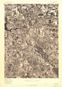
1976 Map of Hart NE
USGS Topo · Published 1976About this map
Hart is the central focus of this 1976 orthophotograph, providing a detailed aerial view of the community's interface with the surrounding landscape of Oceana County. This advance print, produced by the U.S. Geological Survey from imagery captured in May 1976, reveals the intricate patterns of agricultural land use and forestry that define the region. The boundary of Weare is visible in the north, showing the transition between established farm plots and more heavily wooded drainages. Because this is an orthophotograph rather than a standard topographic line map, researchers can observe the actual visual texture of the terrain, from individual orchard rows to the specific density of woodlots, offering an empirical record of Michigan's fruit belt geography during the mid-1970s.
Find a feature on this map
2 named features on this map. Tap any name to fly to it.
Don’t see what you’re looking for? This feature index may not catch every label — zoom into the map to look around manually.
Map Details
Editions of this 1976 Hart NE Map
This is the sole edition of this map. No revisions or reprints were ever made.
Other maps of this area

1931 · Hart NW
USGS Topo · 1:31,680

1931 · Custer SW
USGS Topo · 1:31,680

1931 · Hart SE
USGS Topo · 1:31,680

1931 · Hart NE
USGS Topo · 1:31,680

1931 · Walkerville SW
USGS Topo · 1:31,680

1931 · Walkerville NW
USGS Topo · 1:31,680

1932 · Ludington SW
USGS Topo · 1:31,680

1932 · Ludington SE
USGS Topo · 1:31,680

1954 · Milwaukee
USGS Topo · 1:250,000

1958 · Milwaukee
USGS Topo · 1:250,000