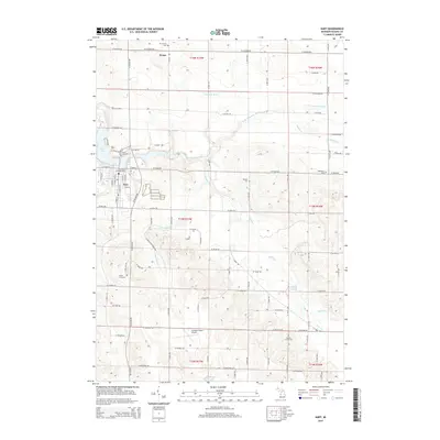
2014 Map of Hart
USGS Topo · Published 2014About this map
Hart serves as the focal point of this survey, situated at the confluence of the Pentwater River and the eastern edge of Hart Lake. The town's grid is established around E Main St and Washington St, reflecting its role as a regional hub. To the north, the small settlement of Weare marks a transition into a landscape defined by an extensive drainage network, including the Waldron Drain and S Br Pentwater River. The topography is etched with numerous creeks such as Huftile Cr, Donaldson Cr, and Hodges Cr, which feed into local catchments like Gales Pond. This survey captures the area's developed infrastructure, from the Oceana County Airport to a series of rural cemeteries including Mt Calvary Cem, North Hart Cem, and Randall Cem that dot the surrounding townships. The arrangement of these sites alongside established routes like W Tyler Rd and W Polk Rd illustrates a community deeply rooted in its local geography.
Find a feature on this map
59 named features on this map. Tap any name to fly to it.
Don’t see what you’re looking for? This feature index may not catch every label — zoom into the map to look around manually.
Map Details
Editions of this 2014 Hart Map
This is the sole edition of this map. No revisions or reprints were ever made.
Other maps of this area

1931 · Hart NW
USGS Topo · 1:31,680

1931 · Custer SW
USGS Topo · 1:31,680

1931 · Hart SE
USGS Topo · 1:31,680

1931 · Hart NE
USGS Topo · 1:31,680

1931 · Walkerville SW
USGS Topo · 1:31,680

1931 · Walkerville NW
USGS Topo · 1:31,680

1932 · Ludington SW
USGS Topo · 1:31,680

1932 · Ludington SE
USGS Topo · 1:31,680

1954 · Milwaukee
USGS Topo · 1:250,000

1958 · Milwaukee
USGS Topo · 1:250,000