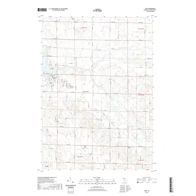
2019 Map of Hart
USGS Topo · Published 2019About this map
The Oceana County Building anchors the city of Hart, situated along the eastern shore of Hart Lake. This 2019 survey documents a landscape defined by the drainage of the S Br Pentwater River and several of its tributaries, including Donaldson Cr, Huitt Cr, and Hodges Cr. The map reveals a high concentration of cemeteries distributed throughout the rural townships, suggesting decades of localized settlement patterns. From the Mount Calvary Cem in the north near Weare to the Oceana Center Cem in the southeast, these sites serve as significant markers for genealogical research in Oceana County. The presence of the Oceana County Airport and the village of Shelby to the south illustrates the modern infrastructure integrated into this agricultural and wooded terrain, while features like Knox Swamp and Gales Pond highlight the persistent natural wetlands of the region.
Find a feature on this map
98 named features on this map. Tap any name to fly to it.
Don’t see what you’re looking for? This feature index may not catch every label — zoom into the map to look around manually.
Map Details
Editions of this 2019 Hart Map
This is the sole edition of this map. No revisions or reprints were ever made.
Other maps of this area

1931 · Hart NW
USGS Topo · 1:31,680

1931 · Custer SW
USGS Topo · 1:31,680

1931 · Hart SE
USGS Topo · 1:31,680

1931 · Hart NE
USGS Topo · 1:31,680

1931 · Walkerville SW
USGS Topo · 1:31,680

1931 · Walkerville NW
USGS Topo · 1:31,680

1932 · Ludington SW
USGS Topo · 1:31,680

1932 · Ludington SE
USGS Topo · 1:31,680

1954 · Milwaukee
USGS Topo · 1:250,000

1958 · Milwaukee
USGS Topo · 1:250,000