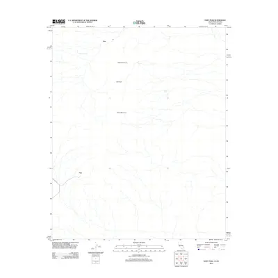
2012 Map of Hart Peak
USGS Topo · Published 2012About this map
Hart and Juan anchor this high-desert landscape in the northeastern Mojave during the early 21st century. The terrain is dominated by the Castle Mountains, which stretch across the central and northern portions of the quadrangle, culminating at Hart Peak. This area, part of the California-Nevada borderlands, reflects a legacy of desert commerce and survival. Remote water sources like Stagecoach Spring, Quail Spring, and Lewis Holes suggest the critical infrastructure once required for travel through this arid environment. The presence of Hart Mine Rd provides a direct link to the mining activity that historically drove settlement in this corner of San Bernardino County. The map documents a sparse but significant network of desert tracks and natural springs that define the human footprint in this mountainous region.
Find a feature on this map
8 named features on this map. Tap any name to fly to it.
Don’t see what you’re looking for? This feature index may not catch every label — zoom into the map to look around manually.
Map Details
Editions of this 2012 Hart Peak Map
This is the sole edition of this map. No revisions or reprints were ever made.
Other maps of this area

1886 · Camp Mohave
USGS Topo · 1:250,000

1892 · Camp Mohave
USGS Topo · 1:250,000

1910 · Ivanpah
USGS Topo · 1:250,000

1912 · Ivanpah
USGS Topo · 1:250,000

1926 · Mohave City
USGS Topo · 1:96,000

1942 · Camp Mohave
USGS Topo · 1:250,000

1942 · Ivanpah
USGS Topo · 1:250,000

1947 · Kingman
USGS Topo · 1:250,000

1948 · Kingman
USGS Topo · 1:250,000

1954 · Kingman
USGS Topo · 1:250,000