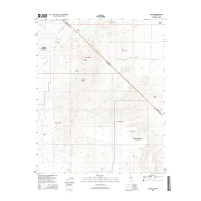
2015 Map of Hart Peak
USGS Topo · Published 2015About this map
Hart Peak serves as a prominent landmark in this desert landscape, where the state boundary between Nevada and California bisects the terrain. This map documents a region defined by the high desert elevations of the Castle Mountains and the Piute Range. The presence of Hart Mine Rd and the settlement of Hart point to the area's mining history, while Stagecoach Spring and Lewis Holes indicate critical water sources in an otherwise arid environment. The vast majority of the land falls within the Mojave National Preserve, which protects the unique geological features and sparse vegetation of the Mojave Desert. The diagonal line of the Clark Co San Bernardino Co boundary and the state line create a complex jurisdictional grid over the open valley floor near Juan.
Find a feature on this map
20 named features on this map. Tap any name to fly to it.
Don’t see what you’re looking for? This feature index may not catch every label — zoom into the map to look around manually.
Map Details
Editions of this 2015 Hart Peak Map
This is the sole edition of this map. No revisions or reprints were ever made.
Other maps of this area

1886 · Camp Mohave
USGS Topo · 1:250,000

1892 · Camp Mohave
USGS Topo · 1:250,000

1910 · Ivanpah
USGS Topo · 1:250,000

1912 · Ivanpah
USGS Topo · 1:250,000

1926 · Mohave City
USGS Topo · 1:96,000

1942 · Camp Mohave
USGS Topo · 1:250,000

1942 · Ivanpah
USGS Topo · 1:250,000

1947 · Kingman
USGS Topo · 1:250,000

1948 · Kingman
USGS Topo · 1:250,000

1954 · Kingman
USGS Topo · 1:250,000