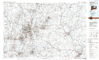
1986 Map of Hartford
USGS Topo · Published 1986About this map
The Connecticut River valley serves as the central spine of this mid-1980s landscape, illustrating the dense urban corridor stretching from Hartford to East Hartford and Windsor. This period reflects the post-war expansion of central Connecticut, where established industrial centers like New Britain and Manchester are linked by the maturing Interstate system, including I-84 and I-91. Beyond the capital city, which features the State Capitol and Trinity College, the map captures the transition to academic and suburban life at the University of Connecticut in Storrs.
Find a feature on this map
114 named features on this map. Tap any name to fly to it.
Don’t see what you’re looking for? This feature index may not catch every label — zoom into the map to look around manually.
Map Details
Editions of this 1986 Hartford Map
This is the sole edition of this map. No revisions or reprints were ever made.
Other maps of this area

1886 · Springfield
USGS Topo · 1:62,500

1887 · Brookfield
USGS Topo · 1:62,500

1887 · Palmer
USGS Topo · 1:62,500

1887 · Granville
USGS Topo · 1:62,500

1888 · Sandisfield
USGS Topo · 1:62,500

1889 · Springfield
USGS Topo · 1:62,500

1889 · Stonington
USGS Topo · 1:62,500

1889 · Derby
USGS Topo · 1:62,500

1889 · Webster
USGS Topo · 1:62,500

1889 · Putnam
USGS Topo · 1:62,500