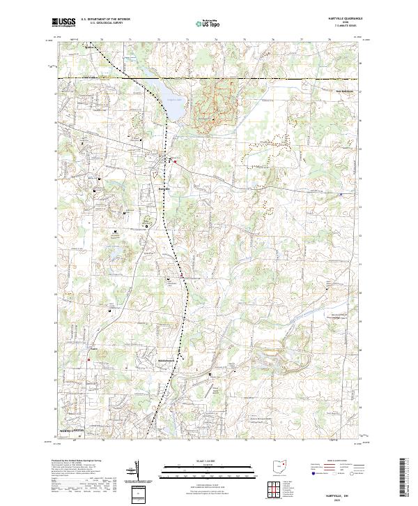
2023 Map of Hartville
USGS Topo · Published 2023About this map
Congress Lake and its surrounding wetlands form a central focal point for this landscape along the Portage and Stark county line. The village of Hartville serves as a local hub, where the headwaters of the Tuscarawas River emerge. This survey documents a deeply rooted community, evidenced by numerous burial grounds such as Oak Grove Amish Cem, Beechy Cem, and Union Cem. The geography here transitions from the residential clusters around Lake Q'Pines to the agricultural reaches of Middlebranch and Cairo in the south. Several small aviation fields, including Hammond Airport and Autumn Orchard Airport, underscore the modern rural character of the area, while the Middle Branch Nimishillen Creek drains the southeastern terrain. The map provides a precise account of local landmarks like Saint Jacobs Lutheran Cem and Werner Chapel Cem, which anchor the townships' long-standing social and religious geography.
Find a feature on this map
99 named features on this map. Tap any name to fly to it.
Don’t see what you’re looking for? This feature index may not catch every label — zoom into the map to look around manually.
Map Details
Editions of this 2023 Hartville Map
This is the sole edition of this map. No revisions or reprints were ever made.
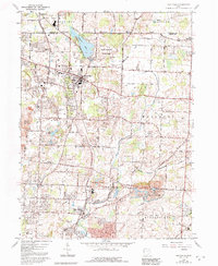
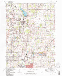
Historical Maps of Middlebranch Through Time
3 maps found