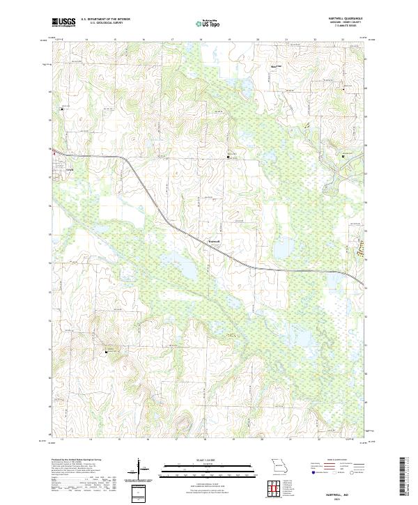
2021 Map of Hartwell
USGS Topo · Published 2021About this map
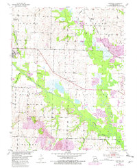
Urich and the small crossroads of Hartwell anchor this West-Central Missouri landscape where the South Grand River meets a network of tributaries. The terrain is defined by its extensive drainage system, including Big Creek, Fishing Cr, and White Oak Cr, which weave through the agricultural heart of Henry County. This land use pattern is reflected in the placement of numerous community burial grounds, such as Hickory Grove Cem, Norris Cem, and Salem Cem, which serve as vital landmarks for local family historians.
Find a feature on this map
62 named features on this map. Tap any name to fly to it.
Don’t see what you’re looking for? This feature index may not catch every label — zoom into the map to look around manually.
Map Details
Editions of this 2021 Hartwell Map
This is the sole edition of this map. No revisions or reprints were ever made.